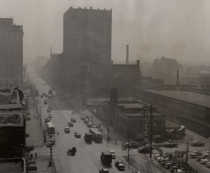
Louisville is famous for a great many things – bourbon, sluggers, horses and classy hats – but it’s also infamously known for its heavy asthma burden and long history of poor air quality (note the thick air in the historic picture below). Louisville is consistently named one of the top 20 “Most Challenging” cities to live with asthma, and was also named the #1 “Spring Allergy Capital” in the US (Asthma and Allergy Foundation of America).
Bottom line: it’s a tough place to live with respiratory disease. Up to 15% of people in Jefferson County have asthma, and asthma and COPD are the 3rd and 4th leading causes of hospitalization in Jefferson County.
Leaders in Louisville have recognized that asthma puts a significant burden on the city’s economic vitality and quality of life. Was there a better answer than, “It’s the Ohio River Valley, we can’t do anything about it?”
The Mayor and other city leaders in Louisville, like Ted Smith, Chief of Civic Innovation, wanted to do something to ease the burden of asthma in the community. In 2012, the City of Louisville partnered with Propeller Health and local funders, including the Owsley Brown Charitable Foundation, Norton Healthcare Foundation and the Foundation for Healthy Kentucky.
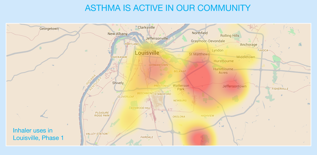
A coalition of groups in Louisville worked to get Propeller’s asthma rescue inhaler sensors to 300 local residents with asthma in Jefferson County. The sensors tracked the frequency, time and location of inhaler use for 13 months, collecting more than 5,400 rescue inhaler use events.
Local participants in the program saw great improvements in their asthma outcomes after tracking their asthma for a year, including:
Right now, these data are being analyzed to find out what might be causing these hotspots, such as air pollution, pollen, traffic emissions or housing quality.
This community asthma pilot project showed that collecting real-time and geographic data on asthma is incredibly valuable for individuals, for their doctors, for local decision-makers and for the community at large.
We knew we wanted to make this project bigger, bolder and more informative. And that’s why we’re expanding the pilot to launch AIR Louisville. Click here to find out more.
A coalition of groups in Louisville worked to get Propeller’s asthma rescue inhaler sensors to 300 local residents with asthma in Jefferson County. The sensors tracked the frequency, time and location of inhaler use for 13 months, collecting more than 5,400 rescue inhaler use events.
Local participants in the program saw great improvements in their asthma outcomes after tracking their asthma for a year, including:
- An increase in asthma-free days
- An increase in control of their asthma
- A better understanding of their personal asthma triggers and improved self-management
Right now, these data are being analyzed to find out what might be causing these hotspots, such as air pollution, pollen, traffic emissions or housing quality.
This community asthma pilot project showed that collecting real-time and geographic data on asthma is incredibly valuable for individuals, for their doctors, for local decision-makers and for the community at large.
We knew we wanted to make this project bigger, bolder and more informative. And that’s why we’re expanding the pilot to launch AIR Louisville. Click here to find out more.
 RSS Feed